|
|
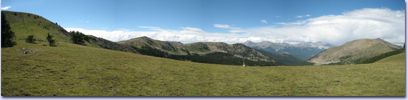
| The CTR: 500 miles and 70,000' of elevation gain winding through
the Colorado Rocky Mountains between Denver and Durango. Approximately
300+ miles of singletrack at elevations ranging from 5500' to a
gasping-for-breath 13,200'. The CTR is a monster! If the monster is in a good mood, you may experience
Colorado's beautiful sunny blue skies and wildflowers blooming as far
as you can see! But, be warned — the CTR's mood can change on a
whim, and you may just as likely find yourself getting besieged by
massive hailstones and lightning bolts. In short, don't come to this
race unprepared — no one will be there to rescue you.
The CTR is similar to The Arizona Trail 300 and Tour Divide. There is no entry fee, no support, no registration, and no prize money. It is a self-timed ITT (Individual Time Trial): all that is provided is a route description, a suggested start time, and a list of results. However, all individuals participating are strongly encouraged to donate time or money to the Colorado Trail Foundation. Without them, we wouldn't have this trail! |
Race Rules:
|
|
Colorado Trail Info: For the most part, the Colorado Trail is very well marked. However, The Trailside Databook is a must-have for a breakdown of each segment with mileages and elevations. The 5th edition (available June 2013) will has marked bicycle detours that match the CTR Detours. Any shortcutting or deviating from the course, intentional or not, will result in a DNF, so please study the route and know it well! You may, of course, ride off course to resupply/sleep/eat as long as you return to the exact same spot you left. The 2019 CTR starts in Durango and uses the Tarryall Detour as described in the offical Colorado Trail guidebook. There are many, many segments of the CT with prodigious amounts of hike-a-bike, and also segments with miles on end of high alpine riding. In particular, the Cataract Ridge segment is not a good place to be during an electrical storm. So come prepared to do some hiking and to exercise good judgment regarding the weather. Here is a terrific CT Trail Bikepacking Guide put together by Craig Fowler. |
 |
|
Course Overview: |
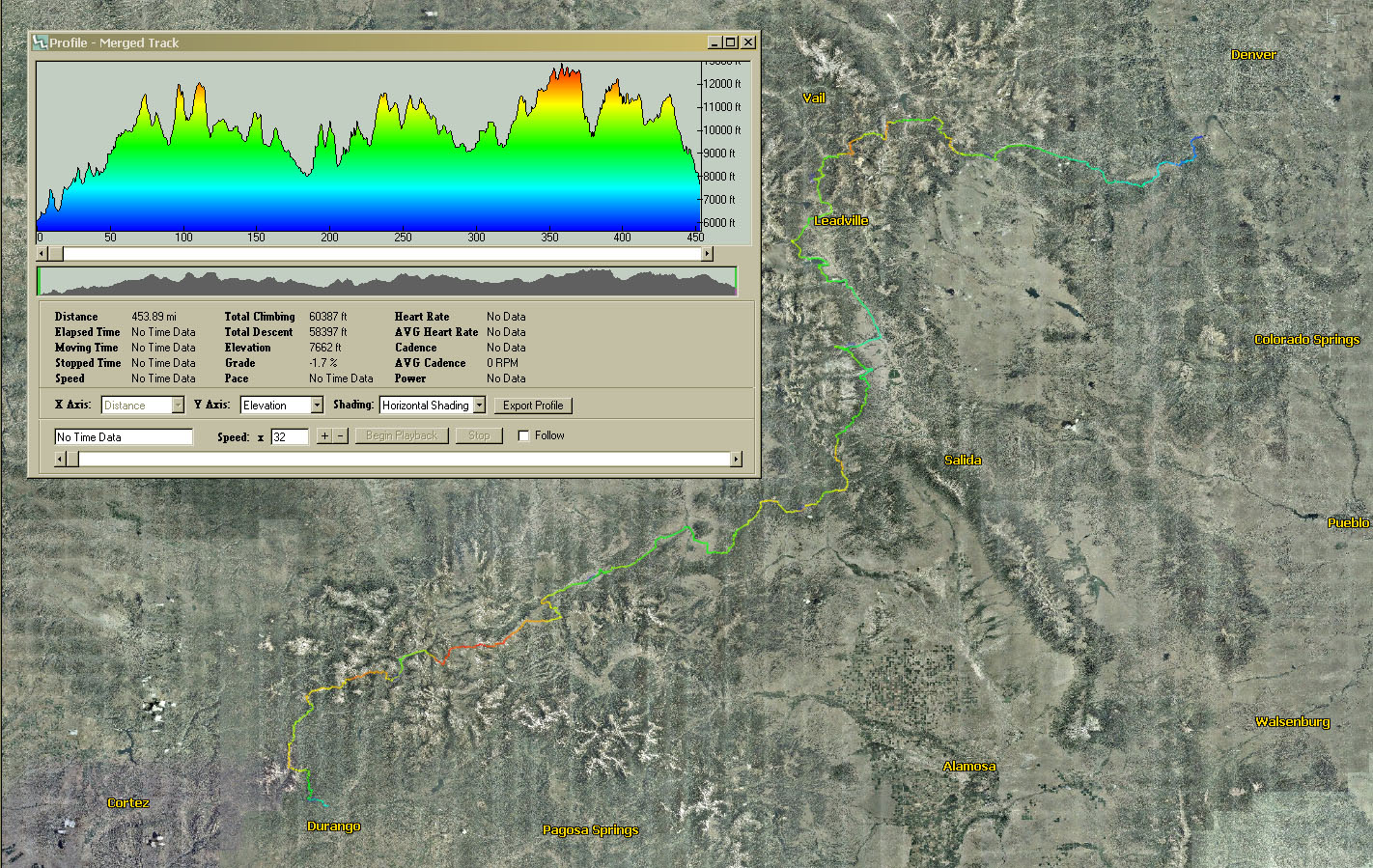 |
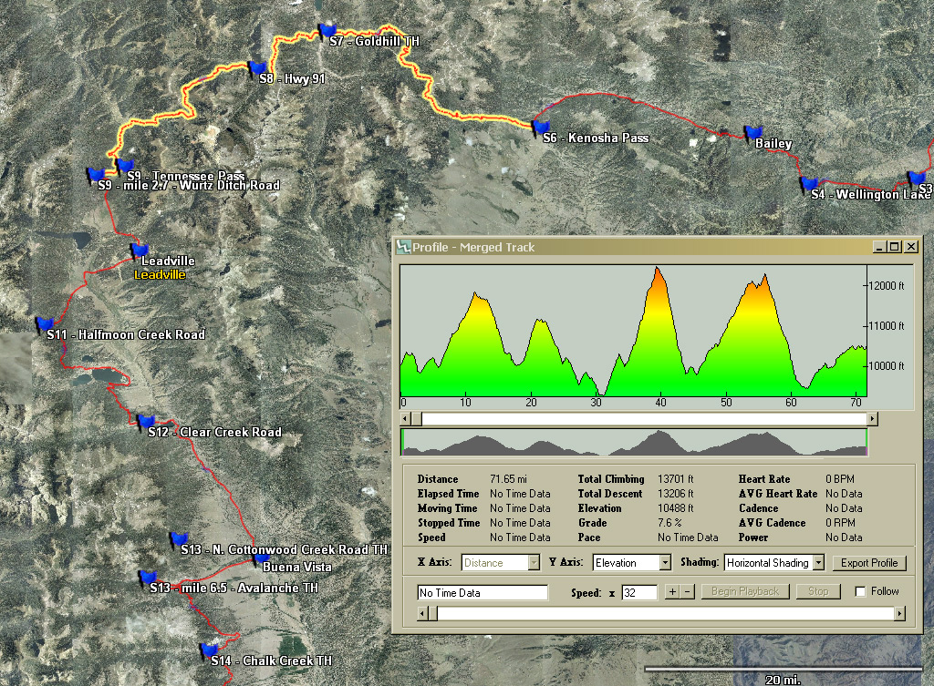
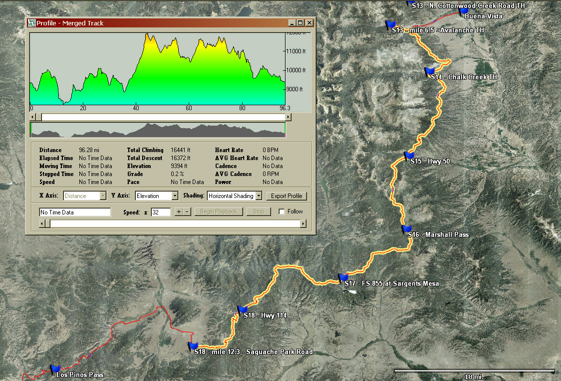
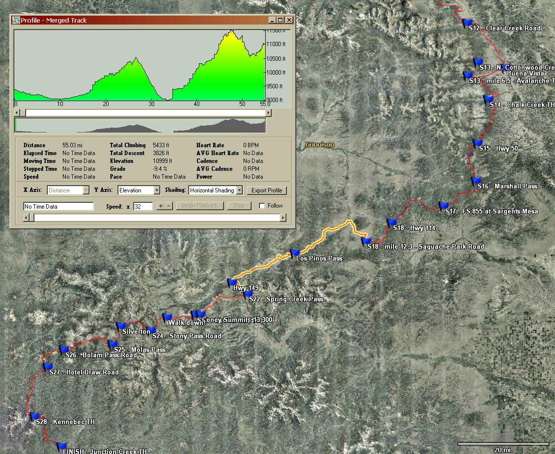
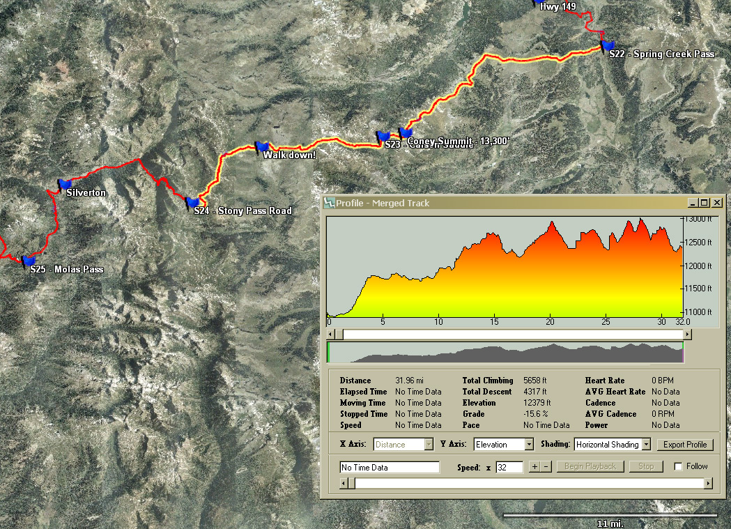
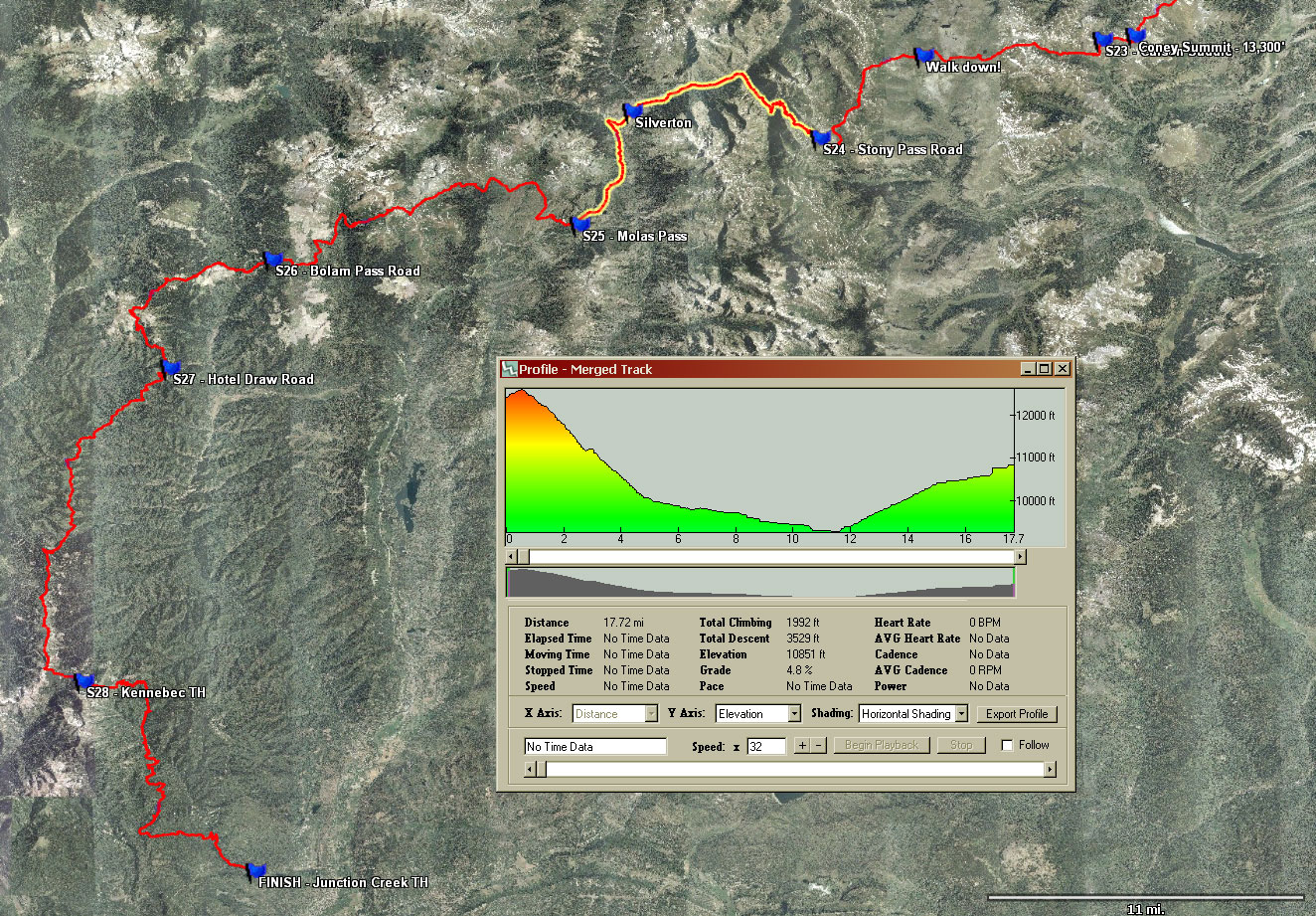
| NOTE: The mileage and elevation gain in this graphic are underestimated. Also, the course has changed to include Tarryall detour, so this graphic is inaccurate. To generate this graphic (and much more!) yourself, download Topofusion, and open the supplied .gpx file. |
| GPS Files: | ||
| The 2018 .gpx file is unchanged from 2016 and 2017, and was stitched together by Toby Gadd. Please see Toby's blogpost to download it. Thanks again, Toby! | ||
| Leadville Bypass - Hand-drawn .gpx file | ||
| Potential re-routes to be posted here prior to the race. | ||
|
Denver to Durango Course Description: |
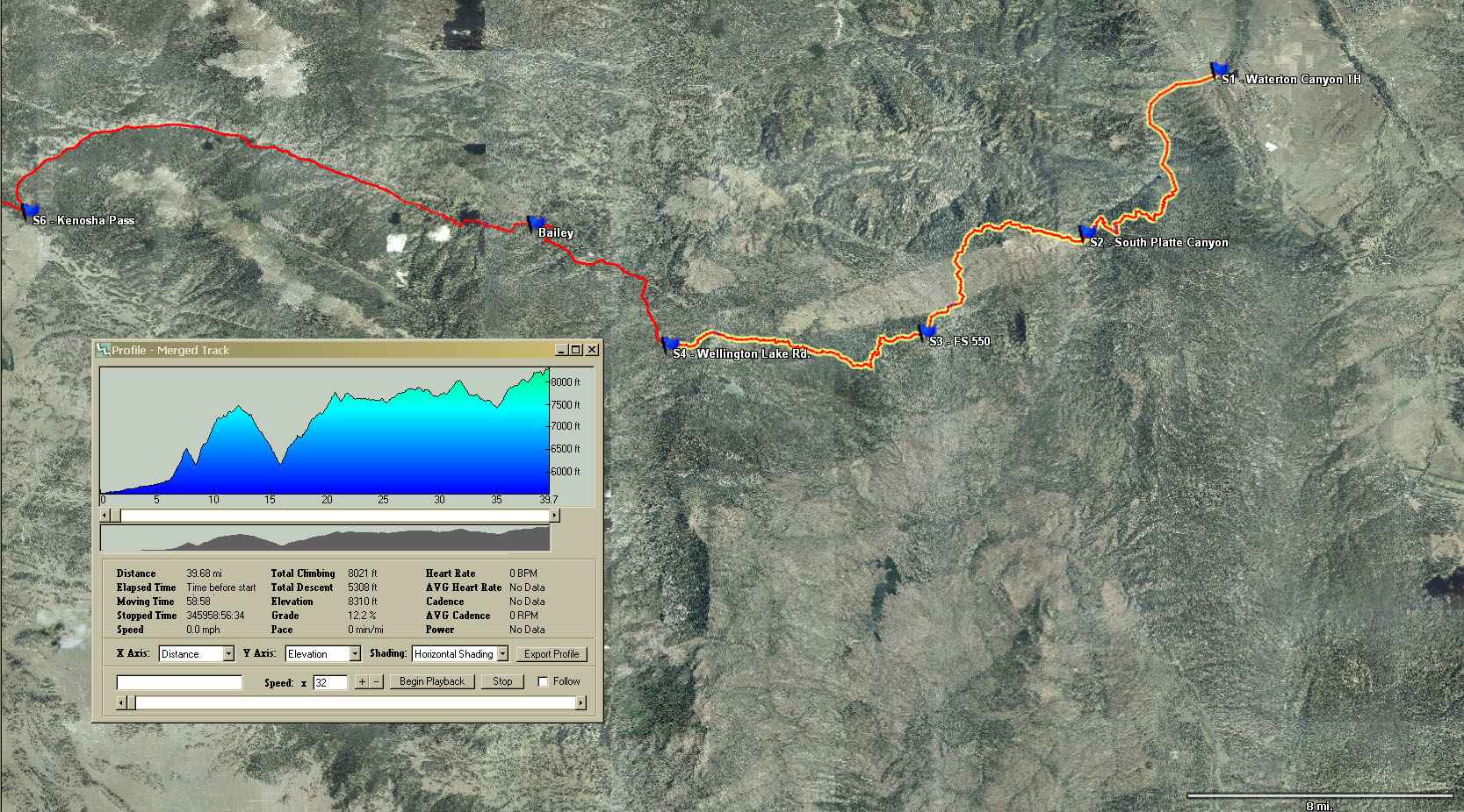
| Wellington Lake Road to Waterton Canyon - Ride Segments 1, 2, and 3. |
| Lost Creek Wilderness Detour - From Wellington Lake road, follow the bike detour through Tarryall as described in the official guidebook. Rejoin the Colorado Trail for the last few miles of segment 5. Note: 7th edition and older guidebooks start the detour prior to Wellington Lake Rd., but you will ride an extra 2 miles along the CT to Wellington Lake Road as indicated in the 8th edition guidebook. |
| Kenosha Pass to Wurtz Ditch Road - Ride Segments 6, 7, and 8. Ride the first part of Segment 9 to Wurtz Ditch Road. |
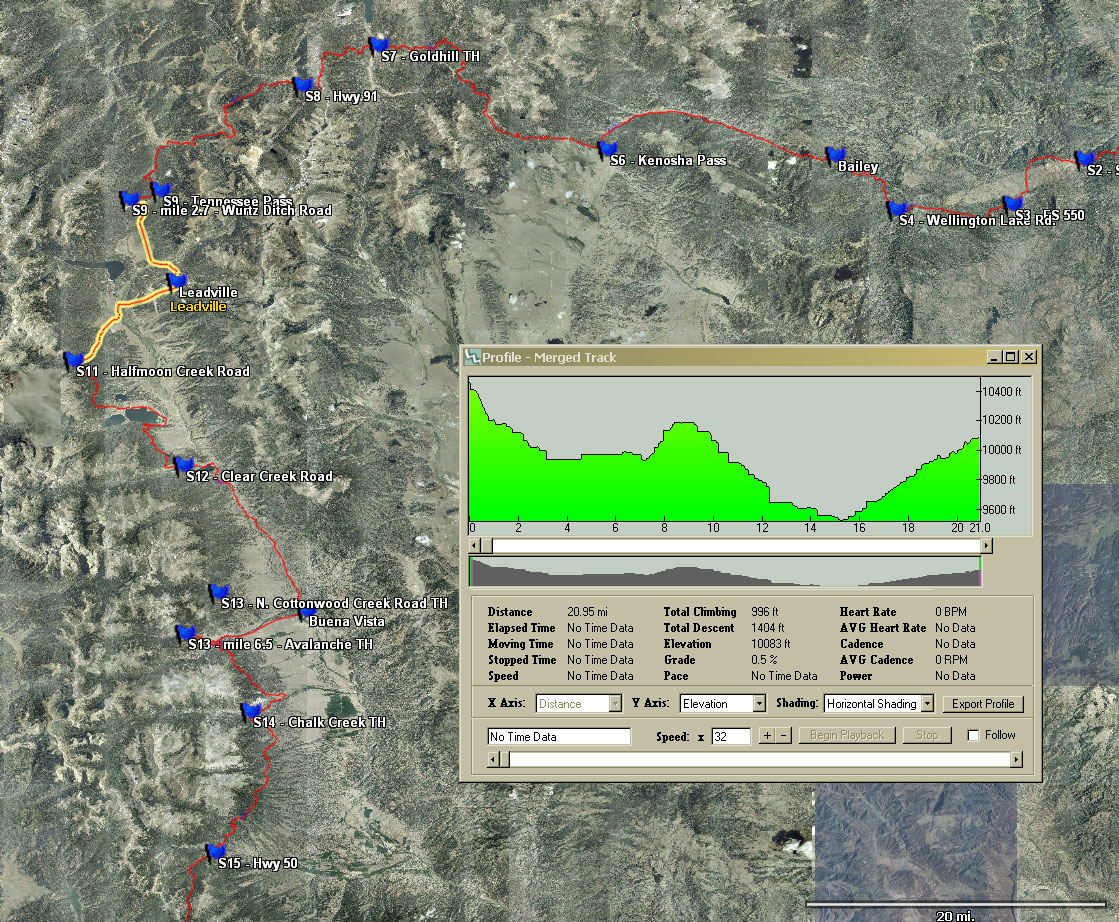
| Holy Cross / Mount Massive Wilderness Detour - Left on Wurtz Ditch Road, left on FS-100, right on US-24 to Leadville. South of Leadville, turn right onto Hwy-300, then left onto Halfmoon Creek Road. Regain CT @ Halfmoon Creek TH and start of Segment 11. |
| Halfmoon Creek to Clear Creek Road - Ride Segment 11. Note: Do not ride the alternate old Hope Pass route. |
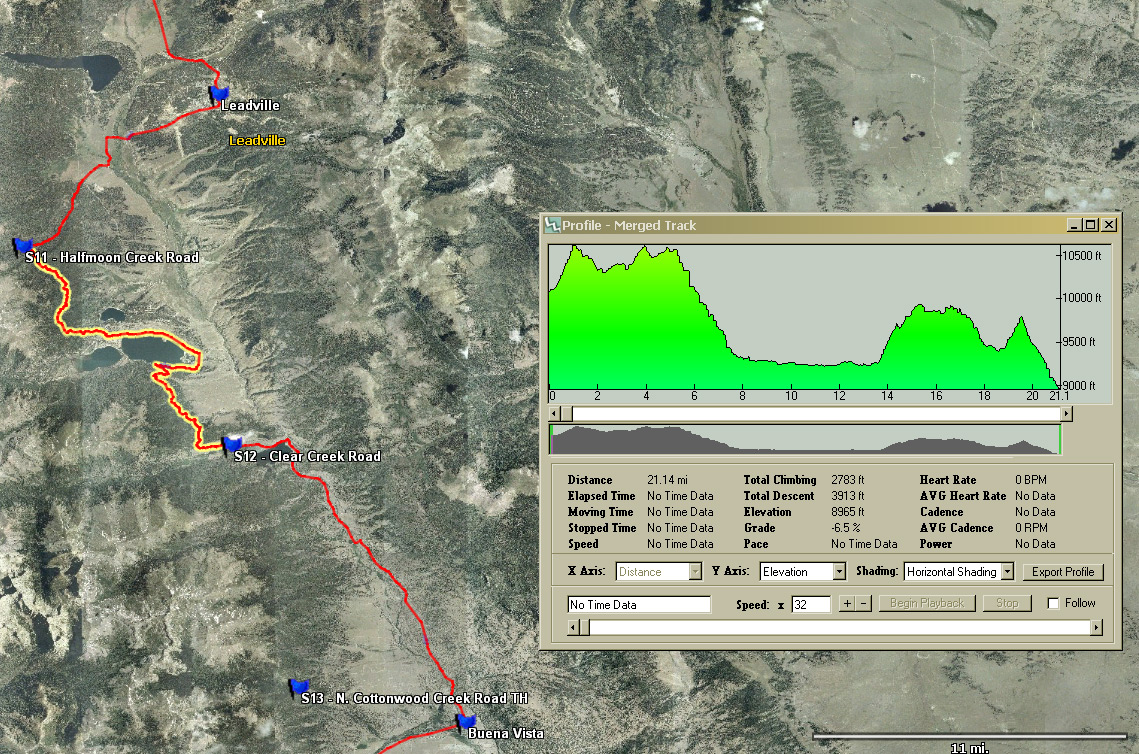
| Collegiate Peaks Wilderness Detour - Left for 3 mi. on Clear Creek Road, right for 5.9 mi. on US-24, left on Rd-371 for 10 mi. on old railroad grade to B.V. Right on Main, across US-24 at light which becomes Rd-306 (Cottonwood Pass Road for 10 mi. to Avalanche TH. This is mile 6.6 of Segment 13. |
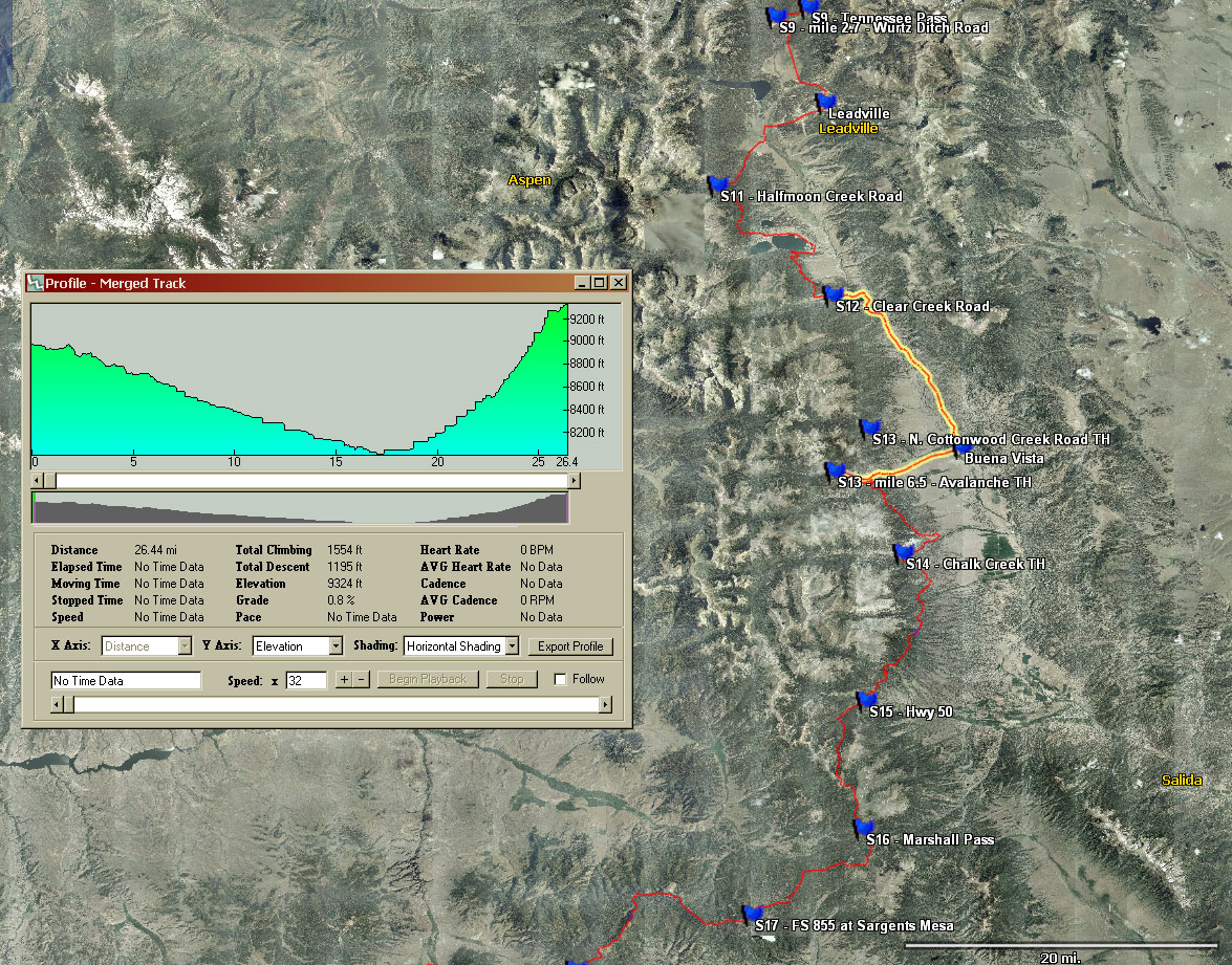
| Avalanche Trailhead to Saguache Park Road - Ride the remainder of Segment 13, then ride Segments 14, 15, 16, 17 and 18. Leave segment 18 at Saguache Park Road to start the La Garita Detour. Note: 7th edition and older guidebooks start the next detour at Cochetopa Pass Rd., but you will ride an extra 6.5 miles along the CT to Saguache Park Road, as indicated in the 8th edition guidebook. |
| La Garita Wilderness Detour - Go right on Saguache Park Road for 2 miles, left on NN-14 for 5.8 miles, left on KK14 (Los Pinos Pass Rd.) for 24 miles, left at Cebolla Rd intersection for 15 miles to Hwy-149. Left on pavement for 7.6 miles to Spring Creek Pass and start of Segment 22. |
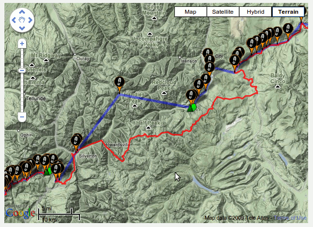
| Spring Creek Pass to Stony Pass Road. - Ride Segments 22, and rerouted (Cataract Ridge) segment 23. Note: This reroute is included in 7th Edition "Revised" and newer guidebooks, as well as the CT Databook, 4th Edition and newer. Pay close attention to the Trailside Databook at the start of Segment 22!. |
| Weminuche Wilderness Detour - Go right on Stony Pass Road and descend to Silverton. Climb the pavement up to Molas Pass and the start of Segment 25. |
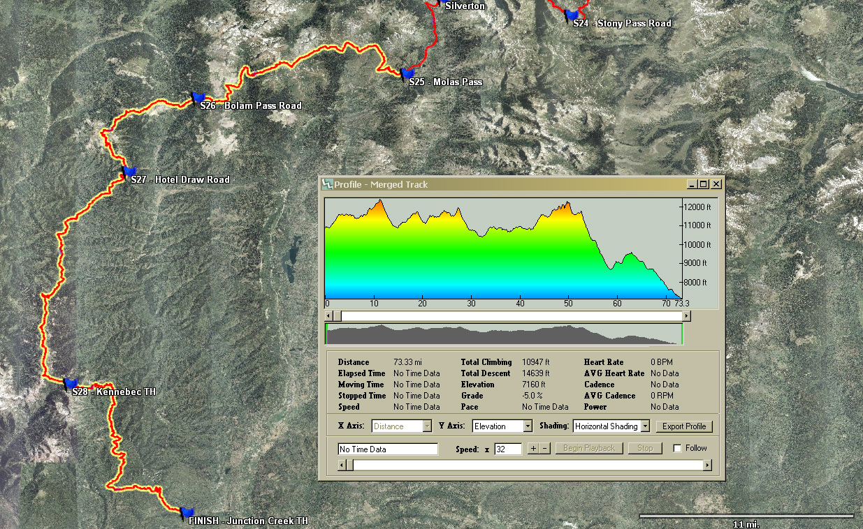
| Molas Pass to Junction Creek Trailhead - Ride Segments 25, 26, 27 and 28. |
|
Training and Preparation: |
| If you've never done a multi-day endurance ride, don't start with the CTR!
Training and prepping for this beast is daunting and all-consuming.
If you're looking for guidance, Dave Harris and Lynda Wallenfels have put together a 12-week CTR specific training plan.
Dave and Lynda are well known in the multi-day endurance mountain biking circle, and best of all, they are donating 10% of all proceeds from the sale of this plan to the Colorado Trail Foundation!
|
| To whet your appetite... |
 |
 |
 |
 |
 |
 |
 |
 |
 |
 |
| CTR Course Record History: | ||
| In 2007, the first CTR ran from Denver to Durango. We used the Tarryall Detour, but skipped the Tenmile range (segment 7) and rode Cinnamon Pass instead of Coney Summit (segment 22) and the old Pole Creek trail (segment 23). This same course was used for 2008. Although Owen Murphy rode this route in 4d08h45m, he missed a short 5 mile section, so the course records for this route are: | ||
| Male: | 5d02h26m - Ethan Passant, 2008 | |
| Female: | 7d01h46m - Trish Stevenson, 2008 | |
| In 2009, the course changed to use the Hwy-285 Detour through Bailey instead of Tarryall, as well as adding the Tenmile Range (segment 7), Coney Summit (segment 22), and the newly constructed, gorgeous Cataract Ridge (segment 23). | ||
| Male: | 4d03h20m - Owen Murphy, 2009 3d23h38m - Jefe Branham, 2012 | |
| Female: | 7d13h23m - Cat Morrison, 2009 6d05h30m - Eszter Horanyi, 2010 5d05h27m - Eszter Horanyi, 2011 | |
| In 2013, the course changed once again to use the long, mostly-gravel Tarryall Detour instead of US-285. The Tenmile Range and Coney/Cataract Segments were kept making the CTR as true to the actual Colorado Trail as possible for Mountain Bikes. In addition, we started from Durango in 2013. In future years, the start will alternate between Durango and Denver. The course records starting from Durango include the prologue from downtown Durango to the Junction Creek TH. | ||
| Male: | 4d04h17m - Jefe Branham, 2013, Durango Start 4d09h55m - Neil Beltchenko, 2014, Denver Start 3d20h44m - Jesse Jakomait, 2015, Durango Start 3d19h40m - Neil Beltchenko, 2016, Denver Start | |
| Female: | 8d17h50m - Chrissy Nacos, 2013 ITT, Denver Start 5d15h36m - Jeannie Dreyer, 2015, Durango Start 6d14h33m - Ashley Carelock, 2018, Denver Start | |
|
2018 CTR Results: Denver Start, Tarryal Detour and Tenmile/Coney/Cataract Segments. |
|
4d06h39m - Timon Fish 4d16h11m - Jefe Branham 5d00h54m - Scott Sidener 5d03h26m - Pete Basinger 5d05h32m - Justin Smith 5d06h13m - Richard Rothwell 5d10h01m - Gordon Macmillan 5d10h30m - Cookie Mike 5d12h53m - Cone Chris 5d14h02m - Josh Cameron 5d14h18m - Pete Schuster 5d17h56m - Colt Fetters 5d18h16m - Mark Lendzion 5d23h03m - Joe Dengler 6d06h21m - Todd Johnson 6d06h27m - Donnie Haubert 6d08h12m - Brad Ells 6d11h37m - Dana Ernst 6d14h26m - Greg Deemer 6d14h33m - Ashley Carelock 6d17h07m - Jim Crossland 6d17h16m - Alexandera Houchin 7d14h30m - Holt Harlan 8d04h29m - Isaac Denny 8d06h53m - Matt Hammett 8d07h31m - Pavel Macháček 8d08h24m - Kristen Tonsager 8d13h06m - Maxwell Lasky 8d15h11m - Jeremy Ordaz 8d17h58m - Petr Ineman 9d03h34m - Derek Henry 9d17h49m - Brian Martin 10d00h17m - Bob Butrico 19d09h37m - Charlie Herron |
|
2018 CTR ITT Results: |
|
ITT, Denver Start 6d15h06m - Chris Ellefson (ITT) 8d04h59m - Artec Durham (ITT) 8d08h55m - Andrew Sayers (ITT) 9d08h55m - Craig Mac (ITT) 9d21h18m - Hunter Hamilton (ITT) 10d05h05m - Erica Evans (ITT) 11d01h27m - Katie Anderson (ITT) |
|
ITT, Durango Start 7d13h35m - Justin DuBois (ITT) |
|
2017 CTR Results: Durango Start, Tarryal Detour and Tenmile/Coney/Cataract Segments. |
|
5d05h40m - Seth Michael
5d16h18m - Greg Lewis 6d07h00m - Justin Dubois 6d09h37m - John Griffiths 6d09h40m - Chris Kampsnider 6d14h35m - Garrett Alexander 7d12h55m - Craig Fowler 7d12h58m - Brett Stepanik 7d13h29m - Dave Staffel 8d09h43m - Nick Gould 8d10h01m - Bill Shand 8d10h37m - Ryan King 8d15h57m - Will Scheel 8d16h27m - Meghan Newlin (Fastest and ONLY female finisher!!) 9d14h03m - Rob Adams 9d16h01m - Drew Huemmler 9d18h39m - Ben Salthouse 12d16h22 - John Schilling |
|
2017 CTR ITT Results: |
| ITT, Denver Start |
|
ITT, Durango Start
8d15h54m - Pat Adrian (Pat started with the group, but had a mechanical and restarted later that day)
|
|
2016 CTR Results: Denver Start, Tarryal Detour and Tenmile/Coney/Cataract Segments. |
|
4d17h33m - Jefe Branham
4d21h49m - Ben Parman 5d05h50m - Ryan Franz 5d14h41m - Aaron Denberg 5d18h09m - Garrett Alexander 5d20h07m - Aaron Johnson 5d23h55m - Robin Schwartz 6d08h46m - Joe Sweeney 6d10h44m - Denny Newell 6d11h45m - Justin Simpson 6d11h45m - Tom Kavanaugh 6d12h09m - Kyle Quinn 6d21h37m - Paul Spencer 6d21h41m - Adam Marcinkiewicz 6d22h05m - Matt Quinn 6d22h16m - Paul Kruger 6d22h40m - Barry Ritchey 6d22h41m - Rob Conklin 7d00h31m - Scott Sidener 7d05h58m - Riley Barclay 7d15h26m - Graham Lierley 7d18h07m - David Goldberg 8d16h31m - Jessica Lobeck 8d19h57m - Alyssum Cohen 9d10h19m - Heather Rose 9d15h12m - Richard Sigouin 10d11h44m - Ian MacNab 11d09h02m - Michael Reuter 11d15h00m - Dave Kirk |
|
2016 CTR ITT Results: |
|
ITT, Denver Start
3d19h50m - Neil Beltchenko (Course Record!!!) 5d16h12m - Josia Morgan* (*US-285 Detour instead of Tarryall) 7d10h58m - Dom DeMaio 7d21h40m - Spencer Skerget 8d59h59m - Erin Carroll |
|
ITT, Durango Start
7d01h36m - Tom Hoppe |
|
2015 CTR Results: Durango Start, Tarryal Detour and Tenmile/Coney/Cataract Segments. (Time includes prologue from Durango to Junction Creek TH. |
|
3d20h44m - Jesse Jakomait (Course Record!!)
4d04h42m - Matt Schiff 4d10h40m - Jefe Branham 5d04h09m - Sam Harney 5d05h01m - Aaron Denberg 5d07h31m - Joe Grant 5d08h21m - Sam Koerber 5d08h24m - Alexander Lussier 5d10h45m - Jay Petervary 5d15h36m - Martin & Jeannie Dreyer 5d16h28m - Montana Miller 5d16h53m - Chaz Dimarzio 5d17h23m - Dylan Taylor 5d17h23m - Andrew Carney 6d07h48m - Nick Patzer 6d08h21m - Brad Kee 6d08h23m - Kurt Ireland 6d10h57m - John Greig 6d11h10m - Justin Simpson 6d15h52m - Jeff Rank 6d18h59m - Alice Drobna 6d20h37m - Robert Orr 7d00h28m - Adam Marcinkiewicz 7d11h19m - Felipe Borja 7d12h31m - Daniel Hockenberger 7d12h35m - Robert Maye 7d17h30m - Mick Lester 7d23h03m - Jens MacAller 8d18h42m - Mark Caminiti 9d14h58m - John Fairbairn 12d12h19m - Will Ritchie |
|
2015 CTR ITT Results: |
|
ITT, Durango to Denver
9d4h48m - Don Jagel |
|
ITT, Denver to Durango
13d00h00m - Roland Sturm (Course Deviations include the summit of Mt. Elbert) |
|
2014 CTR Results: Denver Start, Tarryal Detour and Tenmile/Coney/Cataract Segments. (Timed from Waterton TH to Junction Creek TH) |
|
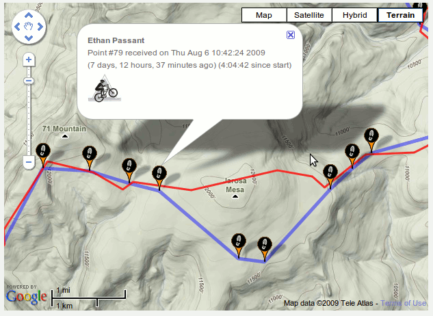
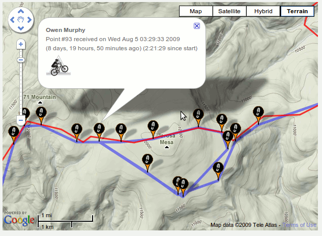
4d09h55m - Neil Beltchenko (Course Record!!!) 5d11h14m - Tim Lutz* 5d11h50m - Christian McCarthy* 6d00h09m - Bryan Klahn 6d07h05m - Dave Stewart 6d12h??m - Garrett Alexander 6d13h27m - Robert Orr 6d14h12m - Chris Kampsnider 6d22h56m - Rick Miller 8d08h56m - Mark Caminiti 8d15h29m - Cullen Barker 9d11h08m - Norb DeKerchove 10d12h48m - Jeffrey Taylor 11d12h00m - Rich Mattson, Jim Reed * Unfortunately, Tim and Christian missed the 2-3 miles of Jarosa Mesa on Segment 22. Same spot that Ethan and Owen spent time exploring in '09, and that Scott missed last year. Perhaps there are STILL a couple of CT markers along that old jeep road. (!?!) We gotta tear those out so this doesn't keep happening? |
|
2014 CTR ITT Results: |
|
ITT, Denver to Durango
12d09h59m - Jim Leikert |
|
2013 CTR Results: Durango Start, Tarryal Detour and Tenmile/Coney/Cataract Segments. (Time includes prologue from Durango to Junction Creek TH. |
|
4d04h17m - Jefe Branham (Course Record!!!) 4d05h13m - Jesse Jakomait 4d09h50m - Matt Schiff 4d17h38m - Jerry Oliver 4d21h30m - Travis Wildeboer, Neil Beltchenko 5d01h10m - Max Morris 5d12h41m - Paul Spencer 5d14h22m - Ryan Franz 5d15h59m - Pete Basinger 5d17h22m - Ben Gannon 5d19h05m - Aaron Johnson 5d21h36m - Pete Schuster, Todd Johnson, Jeff Spencer 6d03h42m - Brady Robinson, Nate Stewart 6d04h05m - Brad Kee 6d04h12m - Matt Fusco 6d07h23m - Joey Ernst, Danny Powers 6d12h28m - Aaron Weinsheimer 6d14h30m - Ty Hopkins 6d14h39m - Jeff Hemperley 6d15h06m - Jeremy Noble 6d15h14m - Adam Lisonbee 6d18h05m - Ian Altman, Cameron Millard 6d22h16m - Dave Stewart 6d22h34m - Dan Hickstein 6d23h25m - Eric Foster 6d23h27m - Paul Bosworth, Jason Thorman 7d13h51m - Forest Baker 7d13h51m - Scott Ruff* 7d21h46m - Dax Massey 7d22h??m - Jeffrey Rank 7d22h15m - Scott Shirey 8d15h10m - Dominic Lauzier 8d16h32m - Cullen Barker 9d14h53m - Mike Sharkey 9d14h58m - Bec Bale 10d07h27m - Mark Caminiti 11d03h27m - Dan Lockery 11d03h28m - Hal Loewen 11d12h35m - Will Ritchie 11d12h38m - Brue Syvertsen 11d12h42m - Teresa Garcia * Unfortunately, Scott missed the 2-3 miles of Jarosa Mesa on Segment 22. Same spot that Ethan and Owen spent time exploring in '09. Turns out there are a couple of CT markers along that old jeep road. (!?!) Any volunteers to go rip those out so this doesn't keep happening? |
|
2013 CTR ITT Results: |
|
ITT, Durango to Denver
5d??h??m - David Picket-Heaps 6d09h35m - Aaron Denberg 6d22h08m - Wayne Keith 7d02h07m - Josiah Morgan ITT, Denver to Durango 7d15h00m - Chris Ellefson 7d02h58m - Justin Simoni 8d17h50m - Chrissy Nacos |
|
2012 CTR Results: US-285 Detour and Tenmile/Coney/Cataract Segments, Waterton Canyon Start |
|
3d23h38m - Jefe Branham (New Course Record!!!) 4d02h25m - Ethan Passant 4d02h39m - Jesse Jakomait 4d19h44m - Max Nuttelman 4d22h03m - Matt Schiff, Dan Miller-Lionberg 5d02h49m - Chris Miller 5d07h20m - Fred Hankinson 5d10h15m - Kurt Sandiforth 5d10h20m - Cat Morrison 5d11h39m - Joseph Shults 5d14h41m - George Lapierre, Travis Wildeboer 5d19h24m - Les Handy 6d05h07m - Alan Goldsmith 6d08h35m - Jeffrey Rank 6d08h55m - Becky Sears 6d09h04m - Tim James 6d09h18m - Kurt Ireland 6d14h35m - Ian Altman, Anthony Arena 6d16h45m - Paul Bosworth 7d04h46m - Toby Gadd 7d13h50m - Dominic Lauzier 7d14h41m - Calvin Davenport 8d02h43m - Tom Kavanaugh, John Harness 8d09h20m - Jeremy Plum 9d06h24m - Mark Caminiti 9d14h00m - Dave Kirk 10d11h10m - Jason Osborne Did Not Finish: I stopped listing DNFs for the last 2 years because it was getting too hard to keep track of them all. There are 30+ more not listed, but Chris Neumann's story needs to be told. He was 15 miles from Junction Creek TH when things went horribly wrong. |
|
2012 CTR ITT Results: |
|
4d20h50m - David Picket-Heaps 4d21h00m - David Wilson 5d16h51m - Kurt Refsnider 6d14h13m - Kevin Camp 7d10h38m - Dan Hickstein (Rode Dgo --> Den) 7d23h11m - Steve Lacey 8d08h15m - Glen Meader, Wayne Keith 8d10h52m - Mark Allen 8d?? - Chad Parker 9d00h55m - Curtis Burge (Rode the '07-'08 course) 9d05h03m - Tom Karpeichik 9d08h56m - Simon Suster 10d8h00m - Jennifer Wolfson |
|
2011 CTR Results: US-285 Detour and Tenmile/Coney/Cataract Segments, Indian Creek Start |
| A short note on finish times. |
|
4d11h54m - Kevin Thomas 4d17h58m - Garrett Peltonen 4d20h51m - Zach Guy 5d05h15m - Jarral Ryter 5d05h27m - Eszter Horanyi 5d07h40m - Jerry Oliver 5d09h00m - John Fulton 5d13h28m - Andrew Carney, Steve Carney 5d14h40m - Cat Morrison 5d14h55m - Joey Ernst, John Ross 5d15h44m - Shawn Gregory 5d18h14m - Aaron Weinsheimer 5d18h19m - Todd Johnson, Chris Miller, Jordan Carr 5d23h00m - James Lindenblatt 5d23h02m - Steve Wilkinson 6d09h59m - Jesse Palmer 6d11h26m - John Fettis 6d12h07m - Jeremy Noble 6d14h36m - Tim Halbakken 7d07h34m - Matt Porembski, Pete Schuster 7d17h02m - Jill Hueckman 8d02h24m - Jonathan Edwards, Andy Heading, Steve Heading 8d05h16m - Bart Spedden 8d09h27m - Brett Ebben 9d10h16m - Clark Davidson 9d11h42m - Marco Capote, Zach Allen 9d14h00m - Chuck Janecek 10d13h09m - Fred Grinnan 10d12h50m - Josh Enck |
|
2011 CTR ITT Results: |
|
6d23h21m - Dan Hickstein 7d14h14m - Ian Altman 9d03h09m - Joe Brannan (Joe rode SW ---> NE) 10d16h59m - Eddie Turkaly (Eddie rode SW ---> NE) |
|
2010 CTR Results: US-285 Detour and Tenmile/Coney/Cataract Segments, Indian Creek Start |
|
4d13h35m - Ethan Passant 4d15h05m - Jesse Jakomait 5d02h10m - Jefe Branham 6d05h30m - Eszter Horanyi 6d08h05m - Timothy Kugler 6d13h25m - Matthew Steinwand 6d16h40m - Garrett Peltonen 6d19h15m - Cat Morrison 7d03h15m - Zach Guy 7d07h40m - Dylan Taylor 7d12h58m - Pawel Kudela 8d08h24m - Jason Johnson 8d09h47m - Bill Guerrera 8d10h43m - Mark Caminiti 8d15h00m - Toby Gadd 9d14h07m - Andy Farish 10d09h54m - Bob Butrico 14d05h31m - Ryan Feild Did not finish: John Fettis - Bolam Pass James Leavesley - Hwy 149 Dave Harris - Hwy 149 Jeff Kerkove - Los Pinos Pass Sean Allan - Hwy 114 Aaron Weinsheimer - Marshall Pass John Fulton - Marshall Pass Jon Csakany - Marshall Pass Emily Brock bailed near Marshall Pass Emily Sportsman - Hwy 50 Scott Sportsman - Hwy 50 Steve Lacey - Salida Gabe Dillon - Leadville Dave Kirk - Mt. Princeton Chris Miller - B.V. Kurt Ireland - B.V. Tom Komoroski - Copper Mountain Bart Spedden - Frisco Greg Bachman - Frisco Jeffrey Zipfel - Frisco Doug Johnson - Swan River Rd. Disqualified: Nathaniel Gallion - rode in a motor vehicle, intentionally dropped gear |
|
2009 CTR Results: US-285 Detour and Tenmile/Coney/Cataract Segments, Waterton Canyon Start |
|
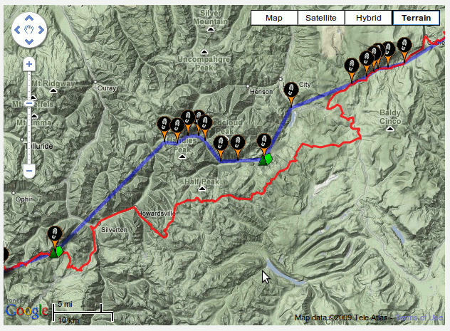
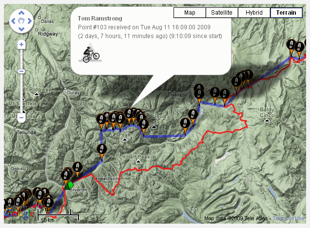
Full Replay as recorded by SPOT trackers |
|
4d03h20m - Owen Murphy Course Record!!! 4d20h24m - Doug Johnson 4d23h13m - Stefan Griebel, Jefe Branham 6d13h29m - Scott Morris 6d16h03m - Dave Harris 6d16h38m - Brian Taylor 6d18h43m - Jeff Oatley 7d08h07m - Rich Otten 7d13h06m - Marshal Bird 7d13h23m - Cat Morrison 7d13h58m - Alex Platt 7d18h53m - David Goldberg 9d05h43m - Mark Caminiti CTR Course Note: In 2009, both the GPS track and data/guidebooks indicated the CT as following a jeep road from above Twin Lakes down to a campground before rejoining a ST. However, new CT markers indicate the trail as following some older ST and newly built trail instead of the jeep road. Because of this discrepancy, either route was deemed acceptable. Course Deviation: 5d13h38m - Ethan Passant Ethan missed a short 3 mile section of trail over Jarosa Mesa on Segment 22. This is the same section that Owen missed, but then somehow realized it, and backtracked to the actual CT. 10d12h38m - Dan Joseph, Nick Thelen 11d09h45m - Tom Jensen Dan, Nick and Tom all rode Cinnamon Pass instead of Coney's + Cataract (Seg. 22/23) Similar mileage, but perhaps 4000' less elevation gain and no hike-a-bike. Did not finish: Joe Bagley - Silverton, after course deviations on Coney's + Cataract Ridge segments Steven Garrett - Silverton, after course deviations on Coney's + Cataract Ridge segments Jason Shelman - Silverton, after course deviations on Coney's + Cataract Ridge segments Tegan Davis - Spring Creek Pass Andrew Carney - Hwy 149 Chuck Ray - Hwy 149 Tim Stern - Hwy 149 Chris Neumann - Los Pinos Pass Road Todd Johnson - Marshall Pass Max Morris - Marshall Pass Karl Wilcox - Hwy 50 Greg Bachman - Chalk Creek Segment 14 Kevin Montgomery - Chalk Creek Segment 14 Robert Kranz - Mt. Princeton Hot Springs Lee Blackwell - Leadville Dave Nice - Copper Mountain Kurt Ireland - Copper Mountain Dan Montgomery - Frisco Ryan Scalva - Kenosha Pass Steve Stalgren - ?? |
|
2008 CTR Results: Tarryall Detour and Cinnamon Pass |
|
5d02h26m - Ethan Passant 5d06h27m - Chris Plesko 5d23h47m - Jeff Oatley 6d04h06m - Brad Kee 7d01h46m - Trish Stevenson 7d06h45m - Dan Montgomery 7d07h00m - Dennis Helton 8d03h14m - Matt Fusco Course Deviation: 5d03h49m - Jason Shelman Jason inadvertently skipped the middle of segment 18, starting the La Garita Wilderness detour at Cochetopa Pass Rd. instead of Saguache Park Road, only realizing this almost a year later. Did not finish: Marshal Bird - 40 miles from Durango Eddie Turkaly - Just before Durango Chris Neumann - Salida Doug Johnson - Hwy 114 Pete Basinger - Hwy 114 Curtis Burge - Cottonwood Hot Springs Tim Graczyk - Buena Vista Chuck Ray - South of Leadville Jim Ishman - Leadville Dave Nice - Copper Mountain Keith Eckstein - Frisco Alison Gannet - Frisco Kyle Stone - Kenosha Pass Travis Butler - Tarryall |
|
2008 CTR ITT Results: |
| 4d08h45m - Owen Murphy Owen inadvertently skipped the end of Segment 3, thus riding 5 miles and ~800' less than the actual CTR route. He only realized this upon closer inspection of the detours for the '09 race. Clearly, he still would have crushed the course record. |
|
2007 CTR Results: Tarryall Detour & Cinnamon Pass |
|
5d05h30m - Jefe Branham 5d05h50m - Stefan Griebel 6d00h17m - Ethan Passant 6d04h51m - Jason Trimm 6d21h55m - Fred Wilkinson 7d05h15m - Matthew Lee Did not finish: ~475 miles - Mark Caminiti ~275 miles - Dan Montgomery ~100 miles - Dave Nice ~30 miles - Jim Ishman |